East India or China Pilot, containing 126 charts chiefly published by James Horsburgh
IOR/X/3630


60 items in this record
Search within this record
The record is made up of 126 maps. It was created in 19th century. It was written in English. The original is part of the British Library: Map Collections.
About this record
- Content
Title from ‘A Catalogue of Manuscript and Printed Reports, Field Books, Memoirs, Maps, etc., of the Indian Surveys, Deposited in the Map Room of the India Office’ published in 1878.
Series of nautical charts published in London by the Hydrographer to the East India Company.
- Extent and format
- 126 maps
- Scale
- Scales differ.
- Scale designator
- Horizontal
- It is grouped into
- 4 imagesRef: IOR/X/3630/9/1-24 imagesRef: IOR/X/3630/9/3-42 imagesRef: IOR/X/3630/102 imagesRef: IOR/X/3630/112 imagesRef: IOR/X/3630/122 imagesRef: IOR/X/3630/132 imagesRef: IOR/X/3630/142 imagesRef: IOR/X/3630/152 imagesRef: IOR/X/3630/162 imagesRef: IOR/X/3630/172 imagesRef: IOR/X/3630/184 imagesRef: IOR/X/3630/19/1-22 imagesRef: IOR/X/3630/20/12 imagesRef: IOR/X/3630/20/22 imagesRef: IOR/X/3630/20/32 imagesRef: IOR/X/3630/20/42 imagesRef: IOR/X/3630/20/52 imagesRef: IOR/X/3630/212 imagesRef: IOR/X/3630/222 imagesRef: IOR/X/3630/232 imagesRef: IOR/X/3630/242 imagesRef: IOR/X/3630/252 imagesRef: IOR/X/3630/262 imagesRef: IOR/X/3630/272 imagesRef: IOR/X/3630/28/12 imagesRef: IOR/X/3630/28/22 imagesRef: IOR/X/3630/29
- Written in
- English in Latin script
- Type
- Map
Archive information for this record
- Original held at
- British Library: Map Collections
- Access conditions
Unrestricted
- Archive reference
- IOR/X/3630
- Date(s)
- 19th century (CE, Gregorian)
Access & Reference
History of this record
Related search terms
- People & organisations
- James Horsburgh
Use and share this record
- Share this record
- Cite this record in your research
East India or China Pilot, containing 126 charts chiefly published by James Horsburgh, British Library: Map Collections, IOR/X/3630, in Qatar Digital Library <https://www.qdl.qa/universal-viewer/81055/vdc_100022840540.0x000001> [accessed 18 February 2025]
- Link to this record
https://www.qdl.qa/en/archive/81055/vdc_100022840540.0x000001
- IIIF details
This record has a IIIF manifest available as follows. If you have a compatible viewer you can drag the icon to load it.https://www.qdl.qa/en/iiif/81055/vdc_100022840540.0x000001/manifestOpen in Universal viewerOpen in Mirador viewerMore options for embedding images
Copyright: How to use this content
- Reference
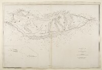
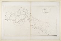
- IOR/X/3630/9/1-2
- Title
- ‘Chart of the Red Sea, Comprising the part above Jiddah, on Mercator’s Projection, Compiled from a Stasimetric Survey, Executed in the Years 1830, 31, 32 & 33 in the Hon.ble Comp.y's Ship Palinurus by Com.der R. Moresby, and Lieu.t T.G. Carless, Indian Navy. T.G. Carless, Draughts.n I.N. Engraved by J.&C. Walker’
- Pages
- 1r:2v
- Author
- Please see item description
- Usage terms
- Public Domain
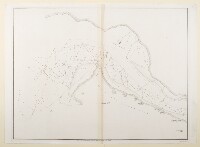
- Reference
- IOR/X/3630/9/3-4
- Title
- ‘Chart of the Red Sea, from Jiddah, to the Straits of Bab-el-Maneb, Surveyed in the Years 1830, 31, 32 & 33 By Capt.n T. Elvon and Lieu.t H.N. Pinching, and completed in 1833 and 34 by Com.der R. Moresby, Indian Navy. T.G. Carless Lieu.t and Draughts.n I.N. Engraved by J.&C. Walker’
- Pages
- 3r:4v
- Author
- Please see item description
- Usage terms
- Public Domain
- Reference
- IOR/X/3630/10
- Title
- ‘Chart of the South East Coast of Arabia, on Mercator’s Projection, Compiled from a Trigonometric Survey, by S.B. Haines, Commander, Indian Navy. Assisted by Lieu.ts Wellsted, Sanders, Jardine & Shepherd, also Mess.rs Ball, Stevens, Rennie, Cruttenden, Grieve & Barrow, Midshipmen, I.N. Engraved by J.&C. Walker’
- Pages
- 5r:5v
- Author
- Please see item description
- Usage terms
- Public Domain
- Reference
- IOR/X/3630/11
- Title
- ‘The Several Bays near Cape Aden, on the Arabian Coast, surveyed Trigonometrically, 1836. Engraved by J.&C. Walker’
- Pages
- 6r:6v
- Author
- Please see item description
- Usage terms
- Public Domain
- Reference
- IOR/X/3630/12
- Title
- ‘Kooria Mooria Bay and Islands, Trigonometrically Surveyed by Commander S.B. Haines, and Lieut. I.P. Sanders, Assisted by Lieu.ts W. Jardine, J. Sheppard & Mess.rs Midshipmen Ball, Stevens & Grieve, of the Indian Navy, 1837. Engraved by J.&C. Walker’
- Pages
- 7r:7v
- Author
- Please see item description
- Usage terms
- Public Domain
- Reference
- IOR/X/3630/13
- Title
- ‘A Trigonometrical Survey of Socotra by Lieut.ts S.B. Haines and I.R. Wellsted assisted by Lieut. I.P. Sanders and Mess.rs Rennie Cruttenden & Fleming Mids.n, Indian Navy. Engraved by R. Bateman, 72 Long Acre’
- Pages
- 8r:8v
- Author
- Please see item description
- Usage terms
- Public Domain
- Reference
- IOR/X/3630/14
- Title
- ‘Chart Intended as an Accompaniment to the Book of Directions for Navigating to, from, and in the East Indies. Engraved by John Bateman’
- Pages
- 9r:9v
- Author
- Please see item description
- Usage terms
- Public Domain
- Reference
- IOR/X/3630/15
- Title
- ‘Trigonometrical Survey of the Harbours of Muttra and Muscat on the Coast of Arabia. By Lieut.ts G.B. Brucks & S.B. Haines, Hon. E.I.C. Marine, 1828. Engraved by Richard Bateman’
- Pages
- 10r:10v
- Author
- Please see item description
- Usage terms
- Public Domain
- Reference
- IOR/X/3630/16
- Title
- ‘Battnah or Burka Coast. Engraved by Richard Bateman’
- Pages
- 11r:11v
- Author
- Please see item description
- Usage terms
- Public Domain
- Reference
- IOR/X/3630/17
- Title
- ‘The Entrance to the Gulf of Persia; and Coast of Arabia from Ras Goberindee to Muscat. Surveyed by Com.r G.B. Brucks, and Lt. S.B. Haines, H.C. Marine, 1828. Engraved by Richard Bateman’
- Pages
- 12r:12v
- Author
- Please see item description
- Usage terms
- Public Domain
- Reference
- IOR/X/3630/18
- Title
- ‘Trigonometrical Survey of the Coast of Arabia, from Ras Goberhindee to Ras Soaote, by Commander G.B. Brucks & Lieutenant S.B. Haines, H.C. Marine, 1828. Engraved by R. Bateman, 85 Long Acre’
- Pages
- 13r:13v
- Author
- Please see item description
- Usage terms
- Public Domain
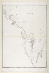
- Reference
- IOR/X/3630/19/1-2
- Title
- ‘Chart of the Gulf of Persia. Constructed from the Trigonometrical Surveys Made by Order of The Hon.ble the Court of Directors of the United English East India Company; by George Barnes Brucks, Commander H.C. Marine. 1830. Engraved by R. Bateman, 85 Long Acre’
- Pages
- 14r:15v
- Author
- Please see item description
- Usage terms
- Public Domain
- Reference
- IOR/X/3630/20/1
- Title
- ‘Part of the Cast of Arabia in the Gulf of Persia Surveyed by Lieut.ts J.M. Guy and G.B. Brucks assisted by Lieut.t R. Cogan H.C. Marine. 1822. Engraved by John Bateman. Sheet 1st'
- Pages
- 16r:16v
- Author
- Please see item description
- Usage terms
- Public Domain
- Reference
- IOR/X/3630/20/2
- Title
- Part of the Cast of Arabia in the Gulf of Persia Surveyed by Lieut.ts J.M. Guy and G.B. Brucks assisted by Lieut.t R. Cogan H.C. Marine. 1822. ‘Engraved by John Bateman. Sheet 2nd'
- Pages
- 17r:17v
- Author
- Please see item description
- Usage terms
- Public Domain
- Reference
- IOR/X/3630/20/3
- Title
- ‘Part of the Arabian side of the Persian Gulf; from Core Abdullah to Ras Reccan, Surveyed by Lieutenants J.M. Guy, G.B. Brucks, & W.E. Rogers, H.E.I.Cs. Marine, 1825. Engraved by Bateman & Son. Sheet 1st and 5th of the Survey of the Arabian Coast’
- Pages
- 18r:18v
- Author
- Please see item description
- Usage terms
- Public Domain
- Reference
- IOR/X/3630/20/4
- Title
- Part of the Arabian side of the Persian Gulf; from Core Abdullah to Ras Reccan, Surveyed by Lieutenants J.M. Guy, G.B. Brucks, & W.E. Rogers, H.E.I.Cs. Marine, 1825. ‘Sheet, 2 and 4. Engraved by R. Bateman’
- Pages
- 19r:19v
- Author
- Please see item description
- Usage terms
- Public Domain
- Reference
- IOR/X/3630/20/5
- Title
- ‘Trigonometrical Survey of the Arabian or Southern Side of the Persian Gulf By Lieutenants J.M. Guy & G.B. Brucks H.C. Marine. 1824. Drawn by Lieutt. M. Houghton Draughtsman H.C.M. Engraved by John Bateman. Sheet 3rd’
- Pages
- 20r:20v
- Author
- Please see item description
- Usage terms
- Public Domain
- Reference
- IOR/X/3630/21
- Title
- ‘Trigonometrical Plan of the Island and Harbour of Bahrein, on the Arabian Side of the Gulf of Persia; by Lieutts. G.B. Brucks, and W.E. Rogers. Hon. E.I.C. Marine Service: 1825. Drawn by Lieutt. M. Houghton; Draughtsman Hon. E.I.C. Marine. Engraved by Bateman and Son’
- Pages
- 21r:21v
- Author
- Please see item description
- Usage terms
- Public Domain
- Reference
- IOR/X/3630/22
- Title
- ‘Plan of the Anchorage off the Town of El Katiff on the Arabian Side of the Persian Gulf by Lieutenants G.B. Brucks and W.E. Rogers H.E.I.C. Marine. 1825. Engraved by Bateman and Son’
- Pages
- 22r:22v
- Author
- Please see item description
- Usage terms
- Public Domain
- Reference
- IOR/X/3630/23
- Title
- ‘Trigonometrical Plan of the Harbour of Grane or Quade in the Gulf of Persia By Lieutts. J.M. Guy and G.B. Brucks H.E.I.C. Marine. 1825. Engraved by Bateman and Son’
- Pages
- 23r:23v
- Author
- Please see item description
- Usage terms
- Public Domain
- Reference
- IOR/X/3630/24
- Title
- ‘Trigonometrical Survey of the Entrances to the Rivers at the Head of the Persian Gulf by Lieuts. G.B. Brucks, & S.B. Haines, H.C. Marine, 1827. Engraved by Richard Bateman’
- Pages
- 24r:24v
- Author
- Please see item description
- Usage terms
- Public Domain
- Reference
- IOR/X/3630/25
- Title
- ‘Part of the Coast of Persia from Ras Tuloop to Bushire Surveyed by Lieutenants G.B. Brucks & R.Cogan, H.E.I.C. Marine. 1826. Engraved by Bateman and Son’
- Pages
- 25r:25v
- Author
- Please see item description
- Usage terms
- Public Domain
- Reference
- IOR/X/3630/26
- Title
- ‘Trigonometrical Plan of Bushire Roads By Lieutenants G.B. Brucks and R.Cogan, H.E.I.C. Marine. 1826. Engraved by Bateman and Son’
- Pages
- 26r:26v
- Author
- Please see item description
- Usage terms
- Public Domain
- Reference
- IOR/X/3630/27
- Title
- ‘The Coast from Bushire to Basadore, in the Persian Gulf, Surveyed by Lieuts. G.B. Brucks & S.B. Haines, H.C. Marine 1828. Engraved by R. Bateman 43 Hart St. Bloomsbury’
- Pages
- 27r:27v
- Author
- Please see item description
- Usage terms
- Public Domain
- Reference
- IOR/X/3630/28/1
- Title
- ‘Trigonometrical Survey of Clarence’s Strait, Gulf of Persia. By Commr. G.B. Brucks and Lieutt. S.B. Haines. H.C. Marine 1828. Engraved by R. Bateman. Sheet 1st’
- Pages
- 28r:28v
- Author
- Please see item description
- Usage terms
- Public Domain
- Reference
- IOR/X/3630/28/2
- Title
- Trigonometrical Survey of Clarence’s Strait, Gulf of Persia. By Commr. G.B. Brucks and Lieutt. S.B. Haines. H.C. Marine 1828. ‘Engraved by R. Bateman. Sheet 2nd’
- Pages
- 29r:29v
- Author
- Please see item description
- Usage terms
- Public Domain
- Reference
- IOR/X/3630/29
- Title
- ‘Chart of the Coast of Persia from Kooe Mubarrack to Krotchey. Surveyed by Commander G.B. Brucks and Lieut. S.B. Haines H.C. Marine 1829. Engraved by Rd. Bateman, 85 Long Acre’
- Pages
- 30r:30v
- Author
- Please see item description
- Usage terms
- Public Domain