Overview
Maps depicting the Gulf and wider region amassed amongst British Government files in agencies because of their important role in daily administrative activities. This vast range of material illustrates various phases of British interest in the region, from exploration and military reconnaissance to delineation of boundaries and colonization.
Maps within Files
Researchers wishing to obtain geographical information gathered by British colonial administrators might first look to the India Office’s Map Collection. However, a substantial amount of cartographic material is dispersed within the India Office The department of the British Government to which the Government of India reported between 1858 and 1947. The successor to the Court of Directors. Records (IOR) – administrative records relating to Britain’s colonies – among the textual records to which they closely relate.
British Political Agents in charge of colonial administration were instructed to obtain maps of areas for which they were responsible. They produced or acquired relevant materials in order to maintain political and economic control over areas administered by the Residency An office of the East India Company and, later, of the British Raj, established in the provinces and regions considered part of, or under the influence of, British India. in the Persian Gulf The historical term used to describe the body of water between the Arabian Peninsula and Iran. at Bushire.
However, maps were not just kept for reference at the Residency An office of the East India Company and, later, of the British Raj, established in the provinces and regions considered part of, or under the influence of, British India. , they were also sent to the Home Government in London. Reports, dispatches and official correspondence were often accompanied by maps – both printed and hand-drawn. Since the accompanying documents often included further details on the map’s purpose and context, it is important to consider the cartographic material alongside their accompanying textual records.
Who Produced Maps and Why?
Cartographic material in the IOR reflects the work not only of the India Office The department of the British Government to which the Government of India reported between 1858 and 1947. The successor to the Court of Directors. but of other government departments, too, such as the intelligence branches of the War Department (after 1857, the War Office) including the General Staff, India, and Ordnance Survey (part of the War Office 1855–70).
The War Office (now known as the Ministry of Defence), a department of the British Government directly involved in foreign affairs, was responsible for the training of surveying officers. These surveyors often assisted in the planning and execution of military campaigns and operations, they were involved in exploration and reconnaissance activities and they produced maps that focused on topography and defensive features.
However, military mapmaking was not restricted to the specialist survey units. In fact many administrative staff and low-ranking soldiers drew maps in the course of their duties, illustrating reports and summaries of reconnaissance expeditions.
Military Purposes
As well as topographical and reconnaissance work, the War Office also produced maps and sketches depicting military campaigns, for example the Mesopotamian campaign of 1914–18. This included the large-scale mapping of various districts in the region with communication features, including roads, railway lines, canals, as well as sketches of battles and battlefields. These maps contain detailed information depicting the location and movements of the British and their enemy’s forces with names of brigades, reported number of troops and guns, strategic positions and defensive features.
![Detail from map of Shaikh Saad and Kut-Al-Amara [Al-Kūt] compiled from ground and air reconnaissance, produced to illustrate the movements of the British and the Turkish military forces on the night 25–26 February, 1917. IOR/L/MIL/17/15/72/2, f 1, f. 1r](https://www.qdl.qa/sites/default/files/styles/standard_content_image/public/ior_l_mil_17_15_72_2_0003_crop_web.jpg?itok=E5onnmAU)
The files also contain maps prepared by the War Office branches which represent plots of land on the outskirts of towns, produced for various purposes. In the 1930s, from their base near Baghdad at Station Hinaidi, the RAF prepared a series of plans of land allotments in Bahrain designated for use by the naval and air bases as a landing ground. Measurements and other topographical details on the property were provided.
Communication
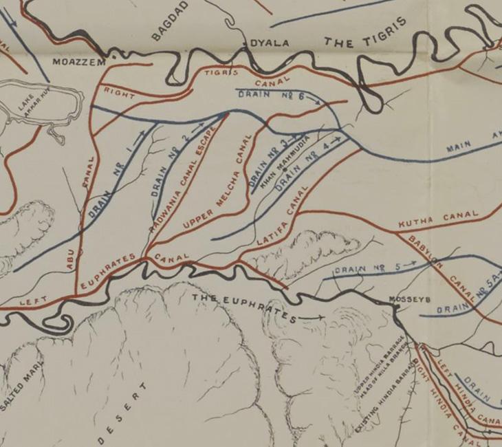
There are many maps and plans showing communication features across the region including land, water and air routes, both existing and under construction. This includes roads ‘traversed by motor car’, railway lines, the courses of waterways and irrigation systems as well as proposed works, including new canals and drainage features. Frequently, too, plans of aerodromes with landing strips and fuel stations were created. These maps are often annotated with further details concerning suggested developments and calculations of estimated construction costs.

Administrative Maps
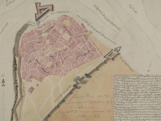
Needless to say, the administrative papers contain a significant number of administrative maps. This material consolidates information referring to administrative matters such as local and national territorial divisions with headquarters and boundaries defined.
There are general maps of the whole region as well as maps covering smaller areas, i.e. provinces and districts. They depict land boundaries but also, importantly, maritime frontiers showing territorial waters with limits of authorities marked up. This was particularly important in the Gulf region. Maps showing international boundaries were often used to resolve disputes over the areas in question and helped to establish which authority certain territory belongs to.

Natural Resources
Technical developments and an increased focus on the extraction of natural resources like minerals and oil in the wider region in the twentieth century, called for the creation of new kinds of maps. A large number of maps were commissioned by the oil companies, for example the Bahrain Petroleum Company (BAPCO) or the Anglo-Persian Oil Company (APOC) in the 1920s–1930s. These maps included newly obtained information gathered by trained surveyors. Geological surveys were also carried out in order to determine whether establishing mines or refinery sites would be profitable; related maps show features such as site accessibility and indicate any necessary works that would have to be undertaken. Many of these maps accompanied oil concessions and were attached to documentation on establishing oil refineries. They frequently show drilling sites with pipelines, pump stations and camp sites.
Most of the material described here was classified as confidential and marked ‘For official use only’, however, it now provides a fascinating insight into the various means by which cartographic material was used to exert and maintain British Imperial power in the Gulf region and beyond.
FURTHER READING
http://www.bl.uk/reshelp/findhelprestype/maps/iormapcolls/indiamapcols.html


