'Sketch of Approaches to Kuweit Harbour and Shatt Al Arab'
IOR/X/3828/3293


2 items in this record
Search within this record
The record is made up of 1 map sheet. It was created in 1912. It was written in English. The original is part of the British Library: Map Collections.
About this record
- Content
Chart F3293.
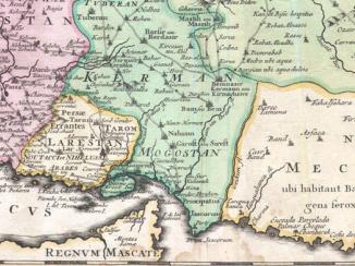
Hydrographic chart of the Shatt al Arab in southern Mesopotamia from the vicinity of Al Basra [Al Basrah, Iraq] approximately 100 miles south-eastwards to its mouth at the head of the Persian Gulf The historical term used to describe the body of water between the Arabian Peninsula and Iran. . Also includes the approaches to Kuweit [Kuwait] Harbour. Portrays hydrology, including depths by soundings Measurements of the depth of a body of water. and contours, sands, rocks and mud, relief by spot heights and shading, vegetation, cultivation, canals, settlements including significant buildings, forts and tombs, and place names, and includes topographical notes and navigational aids, including buoys, lights and prominent buildings.
Compiled 'from various authorities'. Engraved by Davies & Company. Published by the Admiralty and 'issued for Fleet purposes' 1902, with new editions 1904, 1907, 1909 and 1912, and small corrections.
The sheet bears the stamps:
'For Fleet Purposes Only. Care is to be taken that this chart is not allowed to get into the hands of unauthorised persons' in red on the map face.
The number '170.12' in black in the upper right margin.
- Extent and format
- 1 map sheet
- Area map covers
- Map loading...
- Scale
- Scale approximately 1:325,000
- Scale designator
- Horizontal
- Orientation
- North
- Degree coordinates
- Top-left: 30° 46' 48" N, 47° 23' 44.88" E
Top-right: 30° 46' 48" N, 48° 53' 44.88" E
Bottom-left: 29° 2' 44.88" N, 47° 23' 44.88" E
Bottom-right: 29° 2' 44.88" N, 48° 53' 44.88" E - Physical characteristics
Materials: Printed on paper
Dimensions: 597 x 456mm, on sheet 660 x 507mm
- Written in
- English in Latin script
- Type
- Map
Archive information for this record
- Original held at
- British Library: Map Collections
- Access conditions
Unrestricted
- Archive reference
- IOR/X/3828/3293
- Former external reference(s)
- V II 18
- Date(s)
- 1912 (CE, Gregorian)
Access & Reference
History of this record
Related search terms
- Places
- Shatt al ArabBasraMesopotamiaPersian GulfKuweit Harbour
- People & organisations
- Davies & Company
Use and share this record
- Share this record
- Cite this record in your research
'Sketch of Approaches to Kuweit Harbour and Shatt Al Arab', British Library: Map Collections, IOR/X/3828/3293, in Qatar Digital Library <https://www.qdl.qa/archive/81055/vdc_100138148715.0x000001> [accessed 31 March 2025]
- Link to this record
https://www.qdl.qa/en/archive/81055/vdc_100138148715.0x000001
- IIIF details
This record has a IIIF manifest available as follows. If you have a compatible viewer you can drag the icon to load it.https://www.qdl.qa/en/iiif/81055/vdc_100138148715.0x000001/manifestOpen in Universal viewerOpen in Mirador viewerMore options for embedding images
Copyright: How to use this content
- Reference
- IOR/X/3828/3293
- Title
- 'Sketch of Approaches to Kuweit Harbour and Shatt Al Arab'
- Pages
- 1r:1v
- Author
- Admiralty
- Usage terms
- Public Domain
- Reference
- IOR/X/3828/3293
- Title
- 'Sketch of Approaches to Kuweit Harbour and Shatt Al Arab'
- Pages
- 1r:1v
- Author
- Davies and Company
- Usage terms
- Public Domain