Kitāb ʿajāʾib al-aqālīm al-sabʿah كتاب عجائب الأقاليم السبعة Ibn Saʿīd, ʿAlī ibn Mūsá ابن سعيد، علي بن موسى
Or 1524


162 items in this record
Search within this record
The record is made up of Codex A collection of pages, usually gathered into quires, and bound between covers. ; ff. i+74+i. It was created in ca 1300. It was written in Arabic. The original is part of the British Library: Oriental Manuscripts.
About this record
- Content
The earliest-known copy of a geographical manual, written after 1260 by Abū al-Ḥasan ʿAlī ibn Mūsá ibn Muḥammad ibn ʿAbd al-Malik ibn Saʿīd al-Maghribī al-Andalūsī al-Gharnāṭī Nūr al-Dīn (ابو الحسن علي ابن موسى ابن محمد ابن عبد الملك ابن سعيد المغربي الأندلسي الغرناطي نور الدين, d. 1286).
The present copy can be dated to around 1300 on the basis of a collation note on f. 99v which gives the date 700/1300-01. The text was copied by Muḥammad ibn al-Muʾayyad (محمد بن المؤيد, see colophon Section at the end of a manuscript text. , f. 74v, line 7).
Folios 1 and 2 of the present copy are later replacements (see 'Contents', below). A title on the replaced f. 1r names the text as Kitāb ʿajāʾib al-aqālīm al-sabʿah (كتاب عجائب الأقاليم السبعة).
The original title of this work is unconfirmed, as neither of the other surviving copies of this text preserve title pages (see Ducène, 'The Map entitled Geography used by Ibn Sa‘īd (13th C.) and al-‘Umarī (d. 1348) as a Source'. London, Cartography between Europe and the Islamic World 1100-1600, September 8-9, 2014, Queen Mary University (unpublished conference paper). The title Kitāb basṭ al-arḍ fī ṭūlihā wa-al-ʿarḍ (كتاب بسط الأرض في طولها والعرض) appears within the text of Bodleian Library MS Seld. Sup. 76 (copied 1305), whereas the incipit of BNF Arabe 2234 (copied 1314-15) relates it as Kitāb jamaʿhu wa-akhtaṣarhu ʿAlī ibn Saʿīd al-Maghribī al-Andalūsī– raḥimahu Allāh – min kitāb jughrāfiyā fī-l-aqāl[īm] al-sab‘ (كتاب جمعه واختصره علي ابن سعيد المغربي الأندلسي رحمه الله من كتاب جغرافيا في الاقالـ[ـيم] السبع).
From the above it appears that this text is Ibn Saʿīd's abridgement of a fuller work known as Kitāb jughrāfiyā or Kitāb jughrāfiyā fī al-aqālīm al-sabʿ , and apparently now lost. The text has also been referred to as Mukhtaṣar jughrāfiyā (see Pellat, Ch., "Ibn Saʿīd al-Mag̲h̲ribī”, in: Encyclopaedia of Islam , Second Edition) and Kitāb jughrāfiyā (see Ibn Sa`īd al-Maghribī, Kitāb al-jughrāfiyā . ed by Isma’īl al-ʿArabī (Bayrūt: Manshūrāt al-Maktab al-Tijārī lil-Tibāʿah, 1970)).
Drawing on the organisation of Ptolemy's Geographia , the text describes the seven climes and the two zones to the north and south of them, and lists the geographic coordinates of significant cities and natural features. Certain phrases suggest that at least one of Ibn Saʿīd's sources was visual, probably an annotated map like those produced by al-Idrīsī (الإدريسي, d. ca 1165) a century earlier.
As well as numerous corrections and collation notes (reading بلغ مقابلة ) on ff. 9v, 19v, 29v, 38v, 51r, and f. 61r, Arabic marginal notes are found on ff. 22v, 29v, 42r. Pencil notations in English, probably Rawlinson's, are found on the first unfoliated flyleaf, f. 1r (dated 1859 and 1872) and on f. 44v.
Contents:
- [The torrid zone, from the fourth juzʾ onwards]: ff. 1r- 10v, line 2;
- The First Clime (الاقليم الأول), ff. 10v, line 2- f. 28v, line 11;
- The Second Clime (الاقليم الثاني; incomplete: Eastern Arabic foliation f. 30 missing) f. 28v, line 11- ff. 37r, line 2;
- The Third Clime (الاقليم الثالث) f. 37r, line 2- f. 47v, line 13;
- The Fourth Clime (الاقليم الرابع; incomplete: Eastern Arabic foliation ff. 62-74 missing) ff. 47v, line 13- f. 60v, line 17;
- The Fifth Clime (الاقليم الخامس; incomplete: Eastern Arabic foliation ff. 76-78 missing) ff. 61r, line 1- 61v, line 17;
- The Sixth Clime (الاقليم السادس; incomplete: Eastern Arabic foliation ff. 81-88 missing) ff. 62r, line 1-63v, line 17;
- The Seventh Clime (الاقليم السابع; imperfect at the beginning) ff. 64r, line 1-67v, line 8;
- Zone to the north of the seven climes (المعمور في شمال الاقاليم السبعة, Ar. ff. 92-99v) ff. 67v, line 8- f. 74v, line 7.
Begins (f. 1v, line 2-5):
قال محمد بن أحمد الخوارزمي الأرض في وسط السماء والوسط
هو السفل بالحقيقة وهي مدورة كالكرة التي قطرها ذراع
اذا بنا منها شيء او غاب منها شيء لا يخرجها عن الكرة فسبحان
من لا يعلم اسرار حكمته الا هو...
Ends (f. 74v, lines 5-7)
الجزء العاشر من المعمور خلف
الأقاليم جميعه داخل في بلاد ياجوج وماجوج
وآخره البحر المحيط بالمشرق
Colophon Section at the end of a manuscript text. (f. 74v, line 7)
كمل والحمد لله كتبه محمد بن المؤيد
- Extent and format
- Codex A collection of pages, usually gathered into quires, and bound between covers. ; ff. i+74+i
- Physical characteristics
Material: Eastern laid paper
Dimensions: 220 x 145 mm leaf [170 x 105 mm written]
Foliation: Eastern Arabic foliation in black pen, British Museum foliation in pencil
Ruling: Misṭarah ; 17 lines per page; vertical spacing 10 lines per 10 cm
Script: Naskh
Ink: Black ink, with rubricated headings
Decoration: None
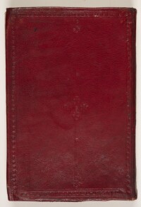
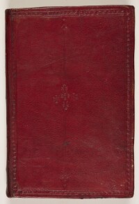
Binding: Red leather binding with blind-tooled frame and central medallion
Condition: Generally good. The binding is stiff and a number of pages have been repaired
Marginalia: Many corrections and some notes in Arabic and English (see scope and content)
Seals: British Museum stamp, f. 1r, 99v
- Written in
- Arabic in Arabic script
- Type
- Manuscript
Archive information for this record
- Original held at
- British Library: Oriental Manuscripts
- Access conditions
Unrestricted
- Archive reference
- Or 1524
- Date(s)
- ca 1300 (CE, Gregorian)
- Provenance
Sir Henry Creswicke Rawlinson: his purchase record, with date April 28, 1844, Baghdad.
- Immediate source of acquisition
Purchased from Major-General Sir Henry Creswicke Rawlinson (1810-95), 24 November 1877
- Finding aids
Rieu, Charles, Supplement to the Catalogue of the Arabic Manuscripts in the British Museum (London: The British Museum, 1894), Item 696, pp. 471-2.
- Select Bibliography
Editions:
- Ibn Saʿīd al-Maghribī, Kitāb basṭ al-arḍ fī al-ṭūl wa-al-ʿarḍ , ed by Joan Vernet i Ginés (Tetouan: Maʿhad Mūlay al-Hassan, 1958)
- Ibn Sa`īd al-Maghribī, Kitāb al-jughrāfiyā . ed by Isma’īl al-ʿArabī (Bayrūt: Manshūrāt al-Maktab al-Tijārī lil-Tibāʿah, 1970)
Studies:
- Ducène, Jean-Charles, 'The Map entitled Geography used by Ibn Sa‘īd (13th C.) and al-‘Umarī (d. 1348) as a Source'. London, Cartography between Europe and the Islamic World 1100-1600, September 8-9, 2014, Queen Mary University (unpublished conference paper). Published in French as:
- Ducene, J-C, 'Quel est ce Kitāb al-Jughrāfiyā cité par al-‘Umarī?', in Vermeulen, U., D’Hulster, K. et Van Steenbergen, J. (eds), Egypt and Syria in the Fatimid, Ayyubid and Mamluk Eras (Leuven, 2016) pp. 187-196 and pp. 401-418.
- Brockelmann, Carl, Geschichte der arabischen Litteratur: Zweite den Supplementbänden angepasste Auflage (GALS), 3 vols (Leiden: E.J. Brill, 1996), vol 1, pp. 410-11, Supplement 1, p. 576
- Pellat, Ch., "Ibn Saʿīd al-Mag̲h̲ribī”, in: Encyclopaedia of Islam , Second Edition
Access & Reference
History of this record
Related material
Related search terms
- Subjects
- Geography--Early works to 1800
- People & organisations
- ʿAlī ibn Mūsá Ibn Saʿīd
Use and share this record
- Share this record
- Cite this record in your research
Kitāb ʿajāʾib al-aqālīm al-sabʿah كتاب عجائب الأقاليم السبعة Ibn Saʿīd, ʿAlī ibn Mūsá ابن سعيد، علي بن موسى, British Library: Oriental Manuscripts, Or 1524, in Qatar Digital Library <https://www.qdl.qa/node/9703> [accessed 5 June 2026]
- Link to this record
https://www.qdl.qa/en/archive/81055/vdc_100081349737.0x000001
- IIIF details
This record has a IIIF manifest available as follows. If you have a compatible viewer you can drag the icon to load it.https://www.qdl.qa/en/iiif/81055/vdc_100081349737.0x000001/manifestOpen in Universal viewerOpen in Mirador viewerMore options for embedding images
Copyright: How to use this content
- Reference
- Or 1524
- Title
- Kitāb ʿajāʾib al-aqālīm al-sabʿah كتاب عجائب الأقاليم السبعة Ibn Saʿīd, ʿAlī ibn Mūsá ابن سعيد، علي بن موسى
- Pages
- front, back, spine, edge, head, tail, front-i, i-r:ii-v, 1r:74v, iii-r:iii-v, back-i
- Author
- Please see item description
- Usage terms
- Public Domain
