!['IRAQ AND THE PERSIAN GULF' [‎383v] (769/862)](https://iiif.qdl.qa/iiif/images/81055/vdc_100000000239.0x000178/IOR_L_MIL_17_15_64_0793.jp2/full/!1200,1200/0/default.jpg "'IRAQ AND THE PERSIAN GULF' [‎383v] (769/862)")
'IRAQ AND THE PERSIAN GULF' [383v] (769/862)
The record is made up of 1 volume (430 folios). It was created in 1944. It was written in English. The original is part of the British Library: India Office The department of the British Government to which the Government of India reported between 1858 and 1947. The successor to the Court of Directors. Records and Private Papers Documents collected in a private capacity. .
Transcription
This transcription is created automatically. It may contain errors.
598 COMMUNICATIONS
and was, until the completion of the standard-gauge line to Mosul,
the normal route taken by passengers coming east by the Simplon and
Taurus expresses.
(i) Baghdad North to Jaloula. The line passes through the out
skirts of Baghdad to Baghdad East, whence it sends a short branch to
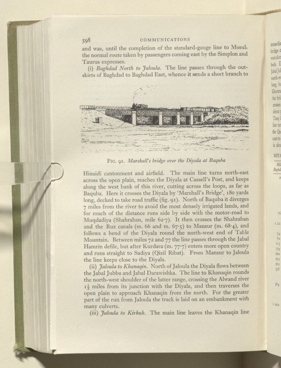
Fig. 91. Marshall's bridge over the Diyala at Baquba
Hinaidi cantonment and airfield. The main line turns north-east
across the open plain, reaches the Diyala at Cassell’s Post, and keeps
along the west bank of this river, cutting across the loops, as far as
Baquba. Here it crosses the Diyala by ‘Marshall’s Bridge’, 180 yards
long, decked to take road traffic (fig. 91). North of Baquba it diverges
7 miles from the river to avoid the most densely irrigated lands, and
for much of the distance runs side by side with the motor-road to
Muqdadiya (Shahraban, mile 627). It then crosses the Shahraban
and the Ruz canals (m. 66 and m. 67-5) to Mansur (m. 68*4), and
follows a bend of the Diyala round the north-west end of Table
Mountain. Between miles 72 and 77 the line passes through the Jabal
Hamrin defile, but after Kurdara (m. 777) enters more open country
and runs straight to Sadiya (Qizil Ribat). From Mansur to Jaloula
the line keeps close to the Diyala.
(ii) Jaloula to Khanaqin. North of Jaloula the Diyala flows between
the Jabal Jubba and Jabal Darawishka. The line to Khanaqin rounds
the north-west shoulder of the latter range, crossing the Alwand river
ii miles from its junction with the Diyala, and then traverses the
open plain to approach Khanaqin from the north. For the greater
part of the run from Jaloula the track is laid on an embankment with
many culverts.
(iii) Jaloula to Kirkuk. The main line leaves the Khanaqin line
About this item
- Content
The volume is titled Iraq and the Persian Gulf The historical term used to describe the body of water between the Arabian Peninsula and Iran. (London: Naval Intelligence Division, 1944).
The report contains preliminary remarks by the Director of Naval Intelligence, 1942 (John Henry Godfrey) and the Director of Naval Intelligence, 1944 (E G N Rushbrook).
There then follows thirteen chapters:
- I. Introduction.
- II. Geology and description of the land.
- III. Coasts of the Persian Gulf The historical term used to describe the body of water between the Arabian Peninsula and Iran. .
- IV. Climate, vegetation and fauna.
- V. History.
- VI. People.
- VII. Distribution of the people.
- VIII. Administration and public life.
- IX. Public health and disease.
- X. Irrigation, agriculture, and minor industry.
- XI. Currency, finance, commerce and oil.
- XII. Ports and inland towns.
- XIII. Communications.
- Appendices: stratigraphy; meteorological tables; ten historical sites, chronological table; weights and measures; authorship, authorities and maps.
There follows a section listing 105 text figures and maps and a section listing over 200 illustrations.
- Extent and format
- 1 volume (430 folios)
- Arrangement
The volume is divided into a number of chapters, sub-sections whose arrangement is detailed in the contents section (folios 7-13) which includes a section on text-figures and maps, and list of illustrations. The volume consists of front matter pages (xviii), and then a further 682 pages in the original pagination system.
- Physical characteristics
Foliation: the foliation sequence (used for referencing) commences at the front cover with 1, and terminates at the inside back cover with 430; these numbers are written in pencil, are circled, and are located in the top right corner of the recto The front of a sheet of paper or leaf, often abbreviated to 'r'. side of each folio.
Pagination: the file also contains an original printed pagination sequence.
- Written in
- English in Latin script View the complete information for this record
Use and share this item
- Share this item
'IRAQ AND THE PERSIAN GULF' [383v] (769/862), British Library: India Office Records and Private Papers, IOR/L/MIL/17/15/64, in Qatar Digital Library <https://www.qdl.qa/archive/81055/vdc_100037366481.0x0000aa> [accessed 22 March 2025]
https://www.qdl.qa/en/archive/81055/vdc_100037366481.0x0000aa
Copy and paste the code below into your web page where you would like to embed the image.
<meta charset="utf-8"><a href="https://www.qdl.qa/en/archive/81055/vdc_100037366481.0x0000aa">'IRAQ AND THE PERSIAN GULF' [‎383v] (769/862)</a> <a href="https://www.qdl.qa/en/archive/81055/vdc_100037366481.0x0000aa"> <img src="https://iiif.qdl.qa/iiif/images/81055/vdc_100000000239.0x000178/IOR_L_MIL_17_15_64_0793.jp2/full/!280,240/0/default.jpg" alt="" /> </a>
This record has a IIIF manifest available as follows. If you have a compatible viewer you can drag the icon to load it.https://www.qdl.qa/en/iiif/81055/vdc_100000000239.0x000178/manifestOpen in Universal viewerOpen in Mirador viewerMore options for embedding images
Copyright: How to use this content
- Reference
- IOR/L/MIL/17/15/64
- Title
- 'IRAQ AND THE PERSIAN GULF'
- Pages
- front, back, spine, edge, head, tail, front-i, 2r:253r, 254r, 255r:429v, back-i
- Author
- East India Company, the Board of Control, the India Office, or other British Government Department
- Usage terms
- Open Government Licence