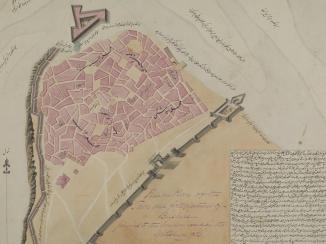
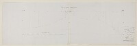
‘Section of b, K, I & C of Durub-ul Hosh’
IOR/X/3228/4
2 items in this record
Search within this record
The record is made up of 1 sheet. It was created in 11 Sep 1843. It was written in English. The original is part of the British Library: Map Collections.
About this record
- Extent and format
- 1 sheet
- Area map covers
- Map loading...
- Scale
- not given
- Scale designator
- Horizontal
- Orientation
- North
- Degree coordinates
- Top-left: 12° 49' 15.29" N, 44° 57' 52.64" E
Top-right: 12° 49' 15.29" N, 45° 4' 55.96" E
Bottom-left: 12° 44' 57.6" N, 44° 57' 52.64" E
Bottom-right: 12° 44' 57.6" N, 45° 4' 55.96" E - It is part of
- 8 imagesRef: IOR/X/3228
- Physical characteristics
Dimensions: 306 x 955 mm
- Written in
- English in Latin script
- Type
- Map
Archive information for this record
- Original held at
- British Library: Map Collections
- Access conditions
Unrestricted
- Archive reference
- IOR/X/3228/4
- Date(s)
- 11 Sep 1843 (CE, Gregorian)
Access & Reference
History of this record
Related material
Related search terms
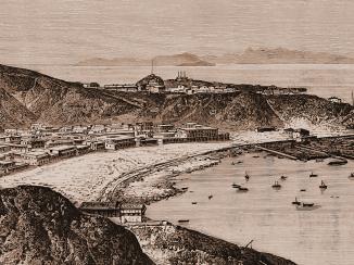
- Places
- Aden
- People & organisations
- William JacobC.W. GrantJ.A. Curtis
Use and share this record
- Share this record
- Cite this record in your research
‘Section of b, K, I & C of Durub-ul Hosh’, British Library: Map Collections, IOR/X/3228/4, in Qatar Digital Library <https://www.qdl.qa/archive/81055/vdc_100024102383.0x000001> [accessed 2 April 2025]
- Link to this record
https://www.qdl.qa/en/archive/81055/vdc_100024102383.0x000001
- IIIF details
This record has a IIIF manifest available as follows. If you have a compatible viewer you can drag the icon to load it.https://www.qdl.qa/en/iiif/81055/vdc_100000006866.0x000001/manifestOpen in Universal viewerOpen in Mirador viewerMore options for embedding images
Copyright: How to use this content
- Reference
- IOR/X/3228/4
- Title
- ‘Section of b, K, I & C of Durub-ul Hosh’
- Pages
- 4r:4v
- Author
- Please see item description
- Usage terms
- Public Domain