Explore Qatar Digital Library
Showing records 1 to 10
-

Coll 30/4 'Shatt-El-Arab Conservancy Board Convention'
This volume contains correspondence between British officials regarding negotiations with the Governments of Iraq and Persia to establish a board to improve ...
1,392 images in record Ref: IOR/L/PS/12/3711 Date(s): 5 Feb 1931-11 Aug 1932
31 images have your search term. View these matches >![]()
![]()
![]()
![]()
![]()
![]()
![]()
![]()
![]()
![]()
![]()
![]()
![]()
![]()
![]()
![]()
![]()
![]()
![]()
![]()
![]()
![]()
![]()
![]()
![]()
![]()
![]()
![]()
![]()
![]()
![]()
-

PZ 3790/33 'Iraq: arrest of Captain Macleod, Harbour Master at Abadan Reach, by Persian Naval Authorities in the entrance of the Shatt-el-Arab.'
The file comprises telegrams, despatches, correspondence, memoranda, and notes, relating to the arrest of a British harbour-master by the Persian naval ...
133 images in record Ref: IOR/L/PS/12/74 Date(s): 27 Jun 1933-4 Mar 1934
19 images have your search term. View these matches >![]()
![]()
![]()
![]()
![]()
![]()
![]()
![]()
![]()
![]()
![]()
![]()
![]()
![]()
![]()
![]()
![]()
![]()
![]()
-

File 4259/1912 'Persian Gulf: Turks and lighting and buoying'
The volume comprises telegrams, despatches, correspondence, memoranda, and notes, relating to lighting and buoying installed by the Turkish Government ...
242 images in record Ref: IOR/L/PS/10/305 Date(s): 1912-1914
20 images have your search term. View these matches >![]()
![]()
![]()
![]()
![]()
![]()
![]()
![]()
![]()
![]()
![]()
![]()
![]()
![]()
![]()
![]()
![]()
![]()
![]()
![]()
-

'File II. IRAQ (3) Vol. 2 Shaikh of Kuwait's Date Gardens on the Shatt-al Arab'
The volume comprises telegrams, despatches, correspondence, memoranda, and notes, relating to three main topics. The first main topic discussed is the ...
682 images in record Ref: IOR/R/15/5/6 Date(s): 14 Aug 1904-18 Aug 1920
31 images have your search term. View these matches >![]()
![]()
![]()
![]()
![]()
![]()
![]()
![]()
![]()
![]()
![]()
![]()
![]()
![]()
![]()
![]()
![]()
![]()
![]()
![]()
![]()
![]()
![]()
![]()
![]()
![]()
![]()
![]()
![]()
![]()
![]()
-

File 1846/1912 Pt 1-2 'Turkey in Asia: Shatt al Arab Riverain Commission'
This file contains correspondence and draft agreements relating to the establishment of the Shatt al Arab Riverain Commission in Ottoman Iraq. The files ...
658 images in record Ref: IOR/L/PS/10/272 Date(s): 1912-1914
-

'Mouth of the Euphrates, Shatt Al Arab and Bahmishir River'. June 1914 Edition with manuscript additions
Chart 1235 (June 1914 Edition with manuscript additions) Hydrographic chart of southern Mesopotamia covering the lower Shatt al Arab (the combined mouth ...
2 images in record Ref: IOR/X/3828/1235/1914 Date(s): Jun 1914
-

'Mouth of the Euphrates, Shatt Al Arab and Bahmishir River'. September 1912 Edition
Chart 1235 (September 1912 Edition) Hydrographic chart of southern Mesopotamia covering the lower Shatt al Arab (the combined mouth of the Euphrates and ...
2 images in record Ref: IOR/X/3828/1235/1912 Date(s): Sep 1912
-

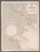
'Sketch of APPROACHES TO KUWEIT HARBOUR AND SHATT AL ARAB'
The sketch map shows approaches to Kuwait [Kuwait] Harbour and Shatt Al Arab. An Admiralty sea map, it states it is compiled from various authorities, ...
2 images in record Ref: IOR/L/PS/20/130, f 43 Date(s): 1909
-

'Sketch of Approaches to Kuweit Harbour and Shatt Al Arab, compiled from various authorities'
A map originally issued for Fleet purposes, 2 June 1902. Large corrections made December 1904, and July 1907. Small corrections made December 1906, July ...
2 images in record Ref: IOR/L/PS/20/263, f 87 Date(s): 1908
-
'Sketch of Approaches to Kuweit Harbour and Shatt Al Arab'
Chart F3293. Hydrographic chart of the Shatt al Arab in southern Mesopotamia from the vicinity of Al Basra [Al Basrah, Iraq] approximately 100 miles south-eastwards ...
2 images in record Ref: IOR/X/3828/3293 Date(s): 1912


