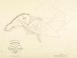
RAF sketch map of the Qatar Peninsula
IOR/R/15/1/606, f 145
2 items in this record
Search within this record
The record is made up of 1 map. It was created in 1935. It was written in English. The original is part of the British Library: India Office The department of the British Government to which the Government of India reported between 1858 and 1947. The successor to the Court of Directors. Records and Private Papers Documents collected in a private capacity. .
About this record
- Content
Imprint:
A.H.Q. [Air Headquarters] Drawing Office Iraq. Drawn by Aprim Bet-Benjamin, Nov. 1935.
Distinctive Features:
Relief shown by hachures.
Map showing the Qatar Peninsula and central part of the Eastern Province Saudi Arabia. Numerous notations concerning terrain features cover the face of the map with routes, the location of wells with good water, and sandy and marshy areas marked.
Includes a key to symbols and a list of sources used in compilation of the map.
Inscriptions:
On verso The back of a sheet of paper or leaf, often abbreviated to 'v'. is an annotation in black ink: ‘Received under Air Officer Commanding, British forces in Iraq’s letter No. S. 10843/2411 dated 19th November 1935; file 61/31. With initials and date ‘12/12/35’.
- Extent and format
- 1 map
- Area map covers
- Map loading...
- Scale
- Scale approximately 1:870,000
- Scale designator
- Horizontal
- Orientation
- North
- Degree coordinates
- Top-left: 26° 54' 19.8" N, 49° 43' 12.36" E
Top-right: 26° 54' 19.8" N, 53° 7' 35.04" E
Bottom-left: 22° 0' 20.52" N, 49° 43' 12.36" E
Bottom-right: 22° 0' 20.52" N, 53° 7' 35.04" E - It is part of
- 512 imagesRef: IOR/R/15/1/606
- Physical characteristics
Materials: Photographic print with additions in ink and crayon on tracing cloth
Dimensions: 592 x 357 mm, on sheet 670 x 431 mm
- Written in
- English in Latin script
- Type
- Map
Archive information for this record
- Original held at
- British Library: India Office The department of the British Government to which the Government of India reported between 1858 and 1947. The successor to the Court of Directors. Records and Private Papers Documents collected in a private capacity.
- Access conditions
Unrestricted
- Archive reference
- IOR/R/15/1/606, f 145
- Date(s)
- 1935 (CE, Gregorian)
Access & Reference
History of this record
Related search terms
Use and share this record
- Share this record
- Cite this record in your research
RAF sketch map of the Qatar Peninsula, British Library: India Office Records and Private Papers, IOR/R/15/1/606, f 145, in Qatar Digital Library <https://www.qdl.qa/archive/81055/vdc_100050153328.0x000009> [accessed 5 April 2025]
- Link to this record
https://www.qdl.qa/en/archive/81055/vdc_100050153328.0x000009
- IIIF details
This record has a IIIF manifest available as follows. If you have a compatible viewer you can drag the icon to load it.https://www.qdl.qa/en/iiif/81055/vdc_100000000193.0x000243/manifestOpen in Universal viewerOpen in Mirador viewerMore options for embedding images
Copyright: How to use this content
- Reference
- IOR/R/15/1/606, f 145
- Title
- RAF sketch map of the Qatar Peninsula
- Pages
- 146r:146v
- Author
- East India Company, the Board of Control, the India Office, or other British Government Department
- Usage terms
- Open Government Licence


